Services
Stunning Aerial Imagery Tailored to Your Vision
Explore our expert drone services designed to capture breathtaking moments with precision and care.
2D/3D Mapping
We create Orthophotos which are High Resolution Overhead Maps that have the visual clarity of photos, combined with the accuracy of a map and the power of geospatial data.
Aerial Photography
We capture high-resolution images from unique perspectives to showcase your property or event beautifully.
3D Virtual Tours
We create High Dynamic Range 360 degree spherical virtual tours similar to Google StreetView which will allow your customers to walk inside of your location as if they were there.
2D / 3D Mapping
Discover how our FAA certified drone pilots capture impressive 2D and 3D models of your location
Example:
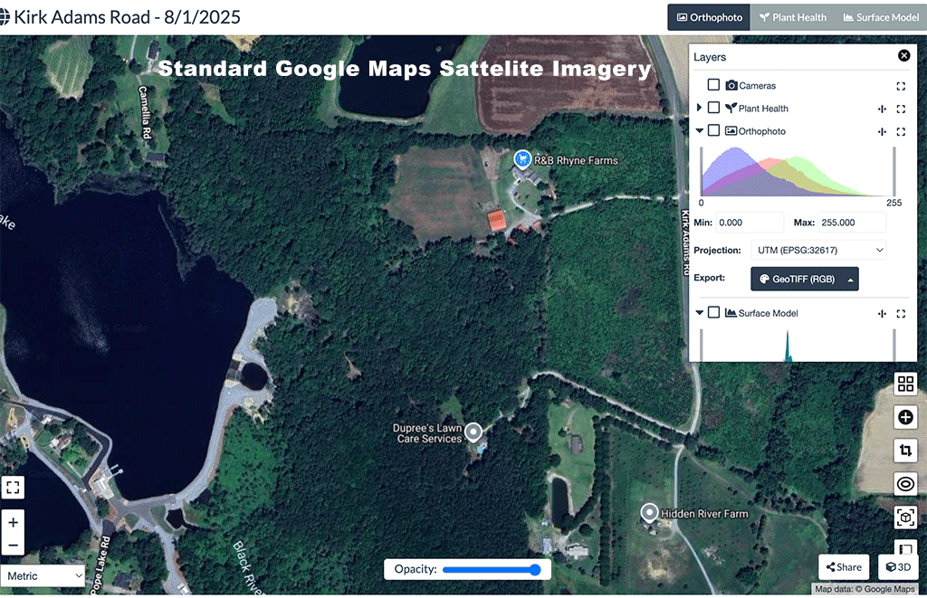
Extremely high resolution overhead mapping
We combine hundreds of overhead high resolution still images to create a very detailed image called an Orthophoto (GeoTIFF). This is a photo that has embedded Geo-Data that can be read and analyzed by programs such as GIS. These images are commonly used for Mapping, Urban Planning, Environmental Monitoring, Agriculture, Disaster Response and Surveying.
GeoTIFF orthophotos
GeoTIFF orthophotos are like super-accurate, map-ready photographs of the Earth’s surface. They’re ideal for analysis, planning, and mapping in all kinds of industries.
- The visual clarity of photos
- The accuracy of maps
- The power of geospatial data
3D Virtual Tours
We build and publish amazing 3D Virtual Tours on Google StreetView and custom websites that we host or they can be self hosted.
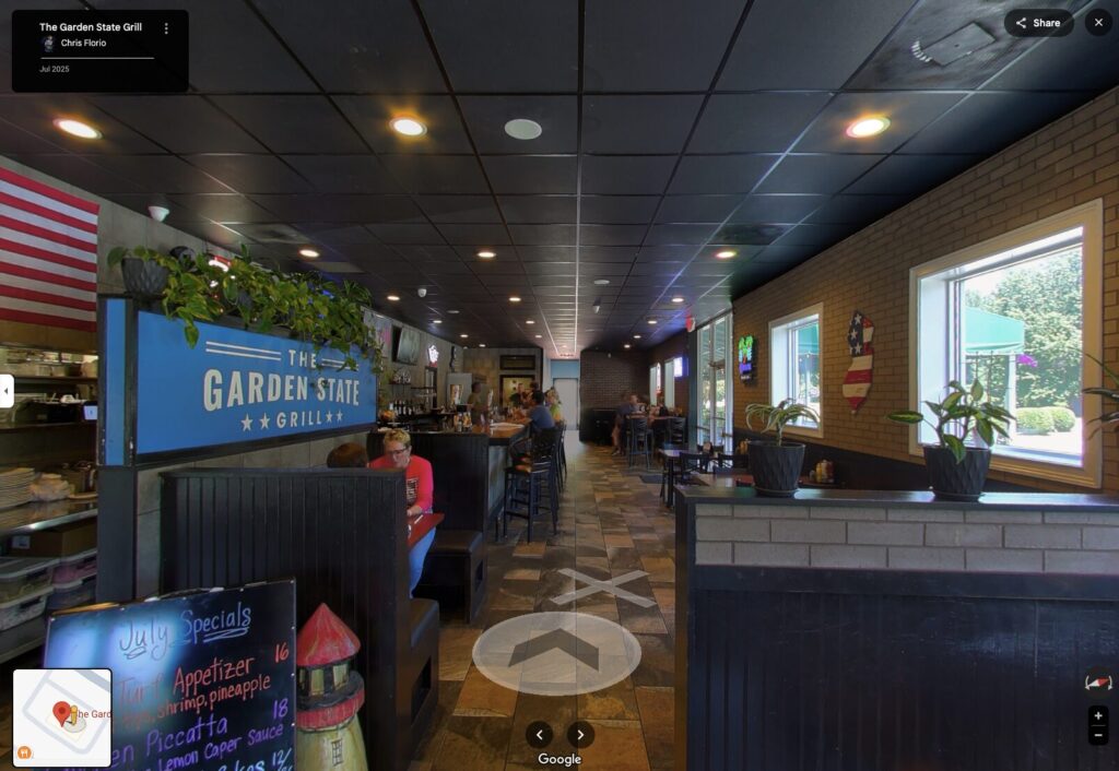
360 Equirectangular Spherical Panoramas
Published on Google StreetView
360 Equirectangular Spherical Panoramas
Custom Web Interface
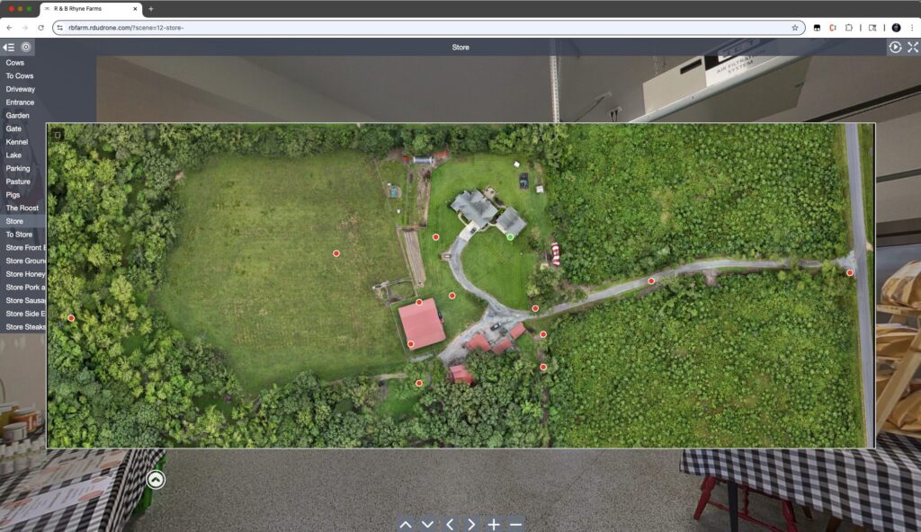
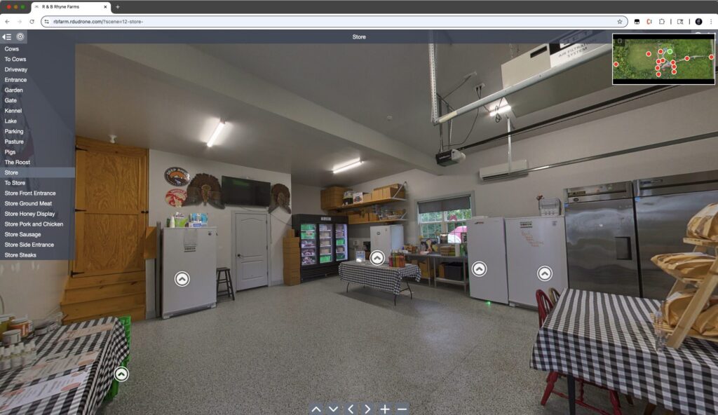
Combine an Orthophoto Map and 3D Tour
Using a drone created map and ground based 3D images
Explore an example of the R & B Rhyne Farm combining an Orthophoto Map and 3D tour using a custom web interface that we are hosting.